The Dynamic Map element enables the mapping of any Location field, allowing for the Dynamic Map display with a pin representing a mapped location.
Only 1 record's location can be displayed per map.
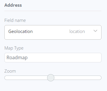
To associate a location with the map, it should be placed within a collection container. Otherwise, the element will not be accepted. In the Data tab, the relevant location field as the Field name should be specified.
Several characteristics can be configured and applied to every map generated in the report:
- Map type: choose between roadmap or satellite view.
- Zoom value: adjust the level of zoom for the map.
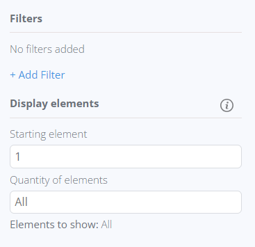
Filters can be applied to the collection container where the map is placed, enabling selective display of maps. You can also set the starting map's serial number and specify the total number of maps to be displayed.
If a Map element is placed inside a Collection Container that hasn't been mapped to any collection yet, no options for Map mapping will be available.
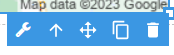
Upon selecting the Dynamic Map in the editor, a bubble panel becomes accessible, offering the following functions:
- Mapping fields using the wrench icon
- Navigating to the parent element where the Dynamic Map is located
- Dragging the element within the editor
- Duplicating the element
- Deleting the element
The Dynamic Map element utilizes Google Maps services to display locations but does not require any additional Google Maps-related settings to be configured.
By default, the map displays the city of Dallas, and this location will be replaced with the record's location after previewing or generating the report.